Community Corner
Soggy, Perhaps Snowy Midweek Storm
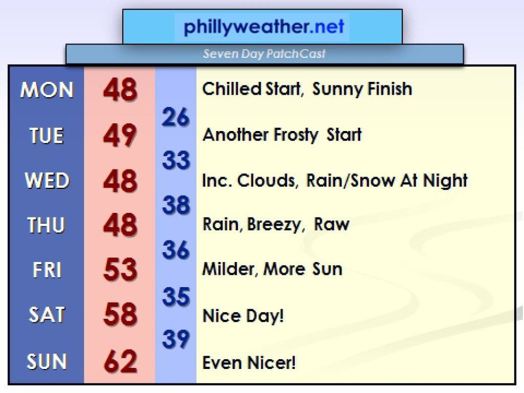
There was nothing nice about the weather last week. There will be nothing nice about Wednesday's storm, either, but odds favor wonderful fall weather ahead.
Many people still are picking up the pieces across our region in the wake of Hurricane Sandy's wrath last week.
Millions lost power at one point, billions of dollars in damage was likely done, and numerous communities were ravaged by the wrath of a late season hurricane that will never be forgotten for this region.
Pouring salt on that open wound is the likelihood that another coastal storm could impact the region on Wednesday into Thursday.
Find out what's happening in Warminsterwith free, real-time updates from Patch.
Computer modeling suggests the brunt of this storm will be felt on Wednesday afternoon into Thursday before the storm pulls away. It will not be as strong as Sandy, but the potential for 50 m.p.h. wind gusts at the shore and 30 m.p.h. gusts across the Philly suburbs is enough to cause additional problems for the area.
Recovery efforts will be slowed by the additional rains, wind, coastal flooding, and perhaps even snow that this midweek storm will provide.
Find out what's happening in Warminsterwith free, real-time updates from Patch.
The best chances for snow will reside over higher terrain to the city's north and west, but, depending on the storm's timing and arrival, we could see snow relatively close to Philadelphia before milder air off the ocean (hopefully) transitions any snow to rain.
It's not a lock that we get snow in the Philly 'burbs, but if the storm develops rapidly, arrives at night (or very early on Wednesday, ahead of schedule), we could see some snow on the front end.
The best chances for accumulation will be in the Poconos.
In any event, rain will be an issue as well for those who do not get snow. An inch or more of rain can't be ruled out across the rest of the region.
Once the coastal storm departs, the weather should improve in time for the weekend. Highs could reach 60 degrees for the first time in nearly two weeks by next Sunday.
Tom Thunstrom is the editor and publisher of Phillyweather.net. You can also follow Phillyweather.net on twitter at @phillywx or on Facebook.